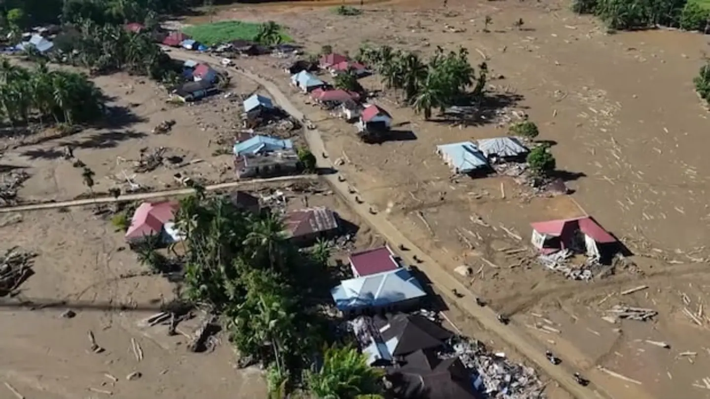
Satellite images have revealed the extensive devastation caused by recent floods across Sri Lanka, Indonesia, and Thailand. The images, captured by Earth-observing satellites, showcase the widespread inundation of residential areas, agricultural lands, and infrastructure, highlighting the severity of the natural disasters impacting these Southeast Asian nations. The floods have displaced thousands of people, disrupted essential services, and caused significant economic losses.
Sri Lanka’s Flood Crisis
In Sri Lanka, torrential rains triggered severe flooding and landslides, particularly affecting the southern and western regions of the island nation. The satellite imagery vividly illustrates the extent of the flooding, with entire villages submerged under water. Rescue teams are struggling to reach affected areas due to damaged roads and bridges. The Sri Lankan government has declared a state of emergency and is coordinating relief efforts to provide food, shelter, and medical assistance to those affected. The long-term impact on the country’s agricultural sector is a major concern, with vast swathes of paddy fields destroyed by the floods.
Indonesia Grapples with Floodwaters
Indonesia has also been battling widespread flooding, with several regions experiencing heavy rainfall and overflowing rivers. Satellite images show the massive scale of the disaster, with large areas of Jakarta and other major cities underwater. The floods have disrupted transportation, leading to traffic gridlock and airport closures. Thousands of residents have been evacuated from their homes, seeking refuge in temporary shelters. The Indonesian government is working to provide clean water, sanitation facilities, and healthcare services to the displaced population. The economic impact of the floods on Indonesia’s manufacturing and tourism sectors is expected to be significant.
Thailand’s Flood Emergency
Thailand is facing a similar crisis, with heavy rains causing widespread flooding in several provinces. Satellite imagery reveals the extent of the flooding in agricultural areas, with rice paddies and orchards submerged under water. The Thai government has mobilized the military and other agencies to assist with rescue and relief efforts. Evacuation centers have been established to provide shelter and assistance to those displaced by the floods. The long-term impact on Thailand’s agricultural output and export earnings is a major concern. The floods have also raised concerns about the potential spread of waterborne diseases, prompting health officials to issue warnings and implement preventive measures.
The satellite images serve as a stark reminder of the increasing vulnerability of Southeast Asian nations to climate change and extreme weather events. Experts emphasize the need for enhanced disaster preparedness, improved infrastructure, and sustainable land management practices to mitigate the impacts of future floods and other natural disasters. International aid organizations are providing support to the affected countries, assisting with rescue operations, and providing humanitarian assistance to those in need.
Image Source: Google | Image Credit: Respective Owner