Monsoon rains have intensified across India, with the India Meteorological Department (IMD) issuing red alerts for several states as heavy downpours continue to disrupt life in both urban and rural areas. From Delhi to Mumbai, widespread rainfall has led to flooding, traffic snarls, and warnings of landslides in hilly regions.
North India struggles with waterlogging
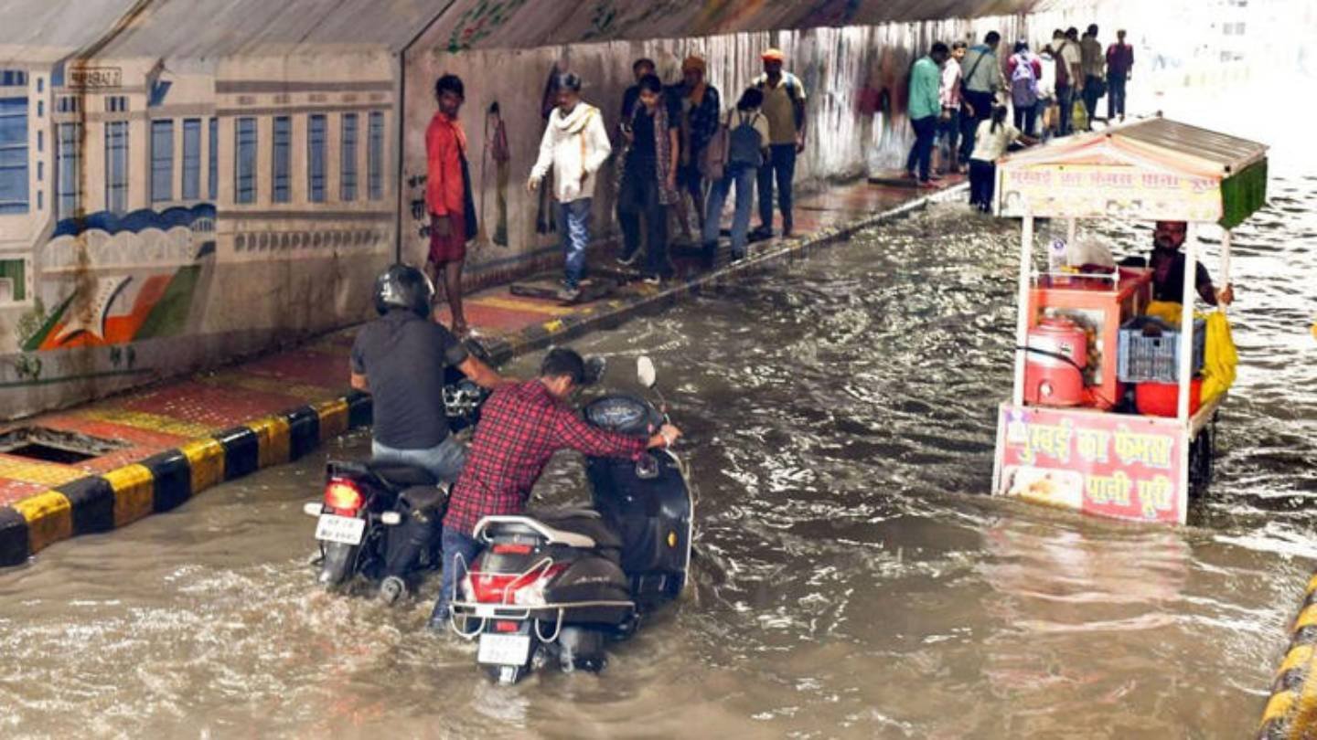
Delhi and the National Capital Region (NCR) witnessed relentless rainfall on Monday, turning roads into streams and leaving commuters stranded for hours. Major areas of Noida, Gurugram and Delhi reported traffic jams and waterlogging that also disrupted emergency services.
The IMD has forecast intermittent rain in the capital until September 5. Experts attributed the downpour to an active monsoon phase coupled with a strong western disturbance, which is also driving heavy showers across the Himalayan states and the northern plains.
Delhi recorded a maximum temperature of 30.8°C, nearly 4 degrees below normal, while the minimum dropped to 23.7°C. Similar conditions are expected on Tuesday, with the mercury likely to hover around 31°C during the day and 22°C at night.
Red and orange alerts in the hills
In Himachal Pradesh and Uttarakhand, the weather has turned dangerous. Southern districts of Himachal are under a red alert, while parts of Uttarakhand remain on orange alert. Authorities have warned of landslides and sudden river swelling, which continue to pose a serious threat.
Over the past 24 hours, Himachal, Uttarakhand, Punjab, parts of western Rajasthan, and Telangana have recorded more than 21 cm of rainfall. Heavy showers have also hit Haryana, Chandigarh, Uttar Pradesh and eastern Rajasthan.
Western and central India on alert
In western India, heavy rainfall is forecast from September 3 to 6 across Gujarat, Konkan-Goa, coastal Karnataka and Madhya Maharashtra. The IMD has warned of extremely heavy rain in Saurashtra-Kutch and hilly interiors on September 4 and 5.
Chhattisgarh, Vidarbha and western Madhya Pradesh are also under watch, with advisories issued for widespread rainfall.
Low-pressure system building in Bay of Bengal
Meteorologists expect a new low-pressure system to develop in the Bay of Bengal. Along with cyclonic circulation and a trough line stretching from Rajasthan to Odisha-Jharkhand, this is likely to expand the zone of heavy rainfall to additional states.
Northeast to receive heavy showers
From September 2, states in the northeast—including Assam, Meghalaya, Nagaland, Manipur, Mizoram and Tripura—are expected to receive consistent heavy rainfall. Odisha, Chhattisgarh, Vidarbha and West Bengal are also likely to see widespread showers.
Authorities on high alert
With the risk of flash floods, landslides, waterlogging and poor visibility, the IMD has urged citizens to remain cautious and avoid unnecessary travel. Low-lying areas and vulnerable hillsides are at particular risk, while crops, infrastructure and transport networks may face severe disruption.
The weather office has stressed the importance of monitoring local advisories closely. While the monsoon remains vital for agriculture, its erratic intensity continues to test disaster preparedness across the country.
Image Source: Google | Image Credit: Respective Owner