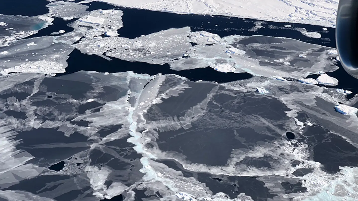
A new statistical model is being introduced to address a known bias in data collected by NASA’s Ice, Cloud, and land Elevation Satellite-2 (ICESat-2), specifically within its ATL06 product. The ATL06 product is crucial for measuring ice sheet elevation changes, which are vital for understanding climate change and sea-level rise. However, the data is affected by subsurface scattering – the way light interacts with snow and ice layers below the surface – leading to inaccuracies in elevation measurements.
Researchers have developed this model to mitigate the impact of this scattering effect, improving the accuracy of ice sheet elevation data. The model focuses on quantifying and correcting for the bias introduced by the scattering of laser photons within the snow and ice. This is particularly important in areas with complex snowpack structures or layered ice, where scattering is more pronounced.
Understanding the Problem
ICESat-2 uses a laser altimeter to measure the distance between the satellite and the Earth’s surface. The ATL06 product provides elevation measurements derived from these laser returns. While highly accurate, the presence of subsurface scattering can distort the returned signal, causing the measured elevation to be artificially lower than the true surface elevation. This bias can significantly impact the interpretation of ice sheet changes over time.
The new statistical model incorporates various factors that influence scattering, such as snow grain size, density, and layering. By accounting for these factors, the model provides a more accurate estimate of the true surface elevation. The model’s development and validation are detailed in a recent publication available through the Earth System Science Open Archive (ESS-OA).
The availability of this improved model represents a significant advancement for the ICESat-2 mission and the broader scientific community studying polar regions. It allows for more reliable monitoring of ice sheet thickness and volume, contributing to a better understanding of the Earth’s cryosphere and its response to climate change. The ESS Open Archive ensures that the model and associated documentation are readily accessible to researchers worldwide, fostering collaboration and accelerating scientific discovery. Further research will likely focus on refining the model and applying it to other regions and datasets to further enhance the accuracy of elevation measurements derived from satellite observations. The implications extend beyond ice sheets, potentially improving measurements in other environments where subsurface scattering is a factor, such as forested areas or mountainous terrain.
Image Source: Google | Image Credit: Respective Owner