From field to screen: the changing landscape of ecology research
The traditional image of ecology research – scientists trekking through remote forests, meticulously collecting data in the field – is undergoing a significant transformation. Driven by technological advancements and the increasing complexity of ecological systems, researchers are increasingly leveraging digital tools and remote sensing technologies to gain a deeper understanding of the natural world. This shift, detailed in an article published by The Hindu, reflects a broader trend in scientific research across disciplines.
Traditionally, ecological studies relied heavily on direct observation, specimen collection, and painstaking manual analysis. While these methods remain valuable, they are often time-consuming, expensive, and limited in scope. Researchers can only observe and collect data from a small area at a time, and the process of analyzing the collected samples can take weeks or even months. Furthermore, the sheer scale of many ecological problems – such as deforestation, climate change, and biodiversity loss – necessitates a more comprehensive and efficient approach.
The Rise of Remote Sensing
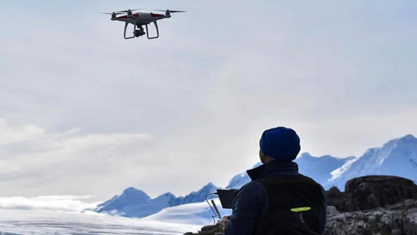
Remote sensing technologies, including satellite imagery, drones, and aerial photography, are now playing a crucial role in ecological research. Satellites equipped with sophisticated sensors can monitor vast areas of land, providing data on vegetation cover, forest health, water quality, and land use changes. Drones offer a more localized and flexible approach, allowing researchers to capture high-resolution images and videos of specific habitats. These technologies enable researchers to track ecological processes over time and across large spatial scales, something that was previously impossible.
For example, scientists can use satellite imagery to detect early signs of forest degradation, identify areas of illegal logging, or monitor the impact of climate change on plant communities. Drones can be used to assess the health of individual trees, map the distribution of invasive species, or monitor the effectiveness of conservation efforts.
Data Analysis and Modeling
Beyond data collection, advancements in data analysis and modeling are also transforming ecology research. Researchers are increasingly using sophisticated statistical techniques and machine learning algorithms to analyze the vast amounts of data generated by remote sensing technologies and field studies. These tools can help identify patterns and relationships that would be difficult or impossible to detect manually. Ecological models are being developed to simulate complex ecological processes and predict the impacts of environmental change. These models can be used to inform conservation strategies and management decisions.
The integration of these digital tools is not simply about replacing traditional methods; it’s about augmenting them. Fieldwork remains essential for gathering ground-truth data and validating remote sensing observations. However, the combination of field data and remote sensing data, coupled with advanced analytical techniques, is providing a more holistic and nuanced understanding of ecological systems. This evolving landscape promises to accelerate the pace of ecological discovery and contribute to more effective conservation efforts in the face of growing environmental challenges.
Image Source: Google | Image Credit: Respective Owner