A recent study published in ESS Open Archive sheds light on the dynamic processes shaping Lituya Bay, Alaska, a location renowned for its extreme geological history, particularly the massive tsunami of 1958. The research focuses on the rapid delta growth occurring within the bay and the lasting impact of past tsunami events, offering valuable insights into coastal geomorphology and hazard assessment.
Lituya Bay’s unique setting, characterized by steep fjord walls and active tectonics, makes it a prime location for studying sediment deposition and erosion patterns. The study utilizes a combination of remote sensing data, including satellite imagery and aerial photographs, along with field observations to analyze the changes in delta morphology over time. Researchers were able to document significant delta expansion, driven by sediment input from glacial meltwater and river discharge.
Delta Formation and Sediment Dynamics
The rapid delta growth observed in Lituya Bay is attributed to several factors. Glacial retreat, a consequence of climate change, has led to increased sediment supply from exposed glacial deposits. Additionally, the steep slopes surrounding the bay facilitate efficient sediment transport via rivers and streams. The study highlights the interplay between these factors and the role of wave action and tidal currents in redistributing sediment within the bay.
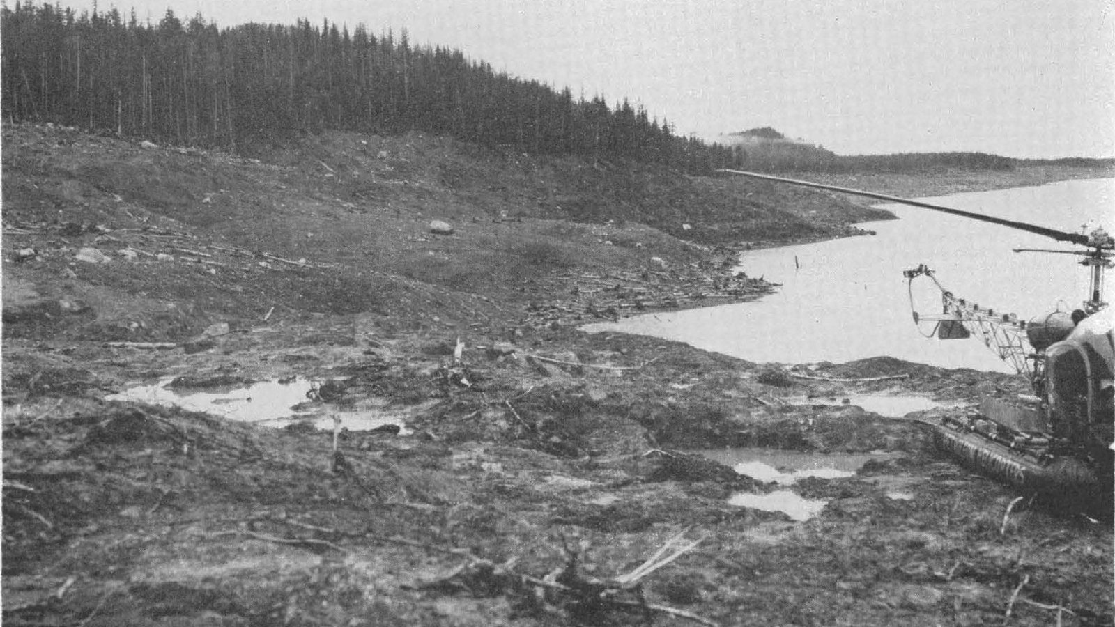
Furthermore, the research investigates the legacy of the 1958 tsunami, which was triggered by a massive landslide into the bay. The tsunami, reaching a staggering height of over 500 meters, caused widespread devastation along the shoreline. The study examines the tsunami’s influence on sediment distribution and coastal erosion, noting the presence of distinct sedimentary layers deposited by the event.
Implications for Hazard Assessment
The findings of this study have important implications for hazard assessment in coastal regions prone to tsunamis and other extreme events. By understanding the processes driving delta growth and sediment dynamics, researchers can better predict the potential for future landslides and tsunamis. The study also emphasizes the need for ongoing monitoring of coastal environments to track changes in sediment deposition and erosion patterns.
The research underscores the importance of interdisciplinary approaches to studying complex coastal systems. By integrating remote sensing data with field observations and numerical modeling, scientists can gain a more comprehensive understanding of the factors shaping these environments. This knowledge is crucial for developing effective strategies to mitigate the impacts of natural hazards and ensure the long-term sustainability of coastal communities. The study serves as a reminder of the powerful forces shaping our planet and the need for continued research to understand and adapt to these changes. The research highlights the complex interplay of geological processes, climate change, and extreme events in shaping coastal landscapes and underscores the importance of continued research and monitoring to mitigate potential hazards.
Image Source: Google | Image Credit: Respective Owner