A new study published in the ESS Open Archive details a comprehensive three-dimensional structural model of the Los Angeles Basin, extending down to its underlying Moho – the boundary between the Earth’s crust and mantle. Researchers utilized a combination of seismic data, including ambient noise tomography and receiver function analysis, to create this detailed map, offering unprecedented insights into the region’s complex geological history and potential seismic hazards.
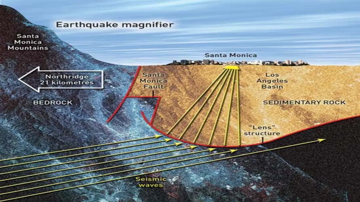
The Los Angeles Basin is a tectonically active region shaped by the interaction of several major faults, including the San Andreas, Puente Hills, and Newport-Inglewood faults. Understanding the basin’s subsurface structure is crucial for accurately assessing earthquake risks and predicting ground motion during seismic events. Previous studies offered fragmented views, but this research provides a unified, high-resolution model.
The study’s findings reveal significant variations in crustal thickness and velocity structure across the basin. Areas with thicker crust correlate with the presence of major fault zones and sedimentary deposits. The Moho depth, which typically ranges between 30 and 35 kilometers, exhibits considerable fluctuations, dipping to greater depths beneath the mountains and becoming shallower under the basin floor. These variations are attributed to the loading of the crust by the extensive sediment fill and the complex tectonic interactions.
Methodology and Data
The research team compiled data from a network of over 300 seismometers deployed throughout Southern California. Ambient noise tomography, a technique that uses naturally occurring seismic noise to image the Earth’s interior, was particularly effective in resolving shallow structures within the basin. Receiver function analysis, which examines the conversion of seismic waves at the Moho, provided precise estimates of Moho depth and velocity contrasts.
The integration of these two techniques allowed the researchers to overcome limitations inherent in each method. For example, ambient noise tomography is sensitive to shallow structures but less accurate at depth, while receiver function analysis provides accurate Moho depths but limited lateral resolution. By combining the datasets, the team created a more robust and comprehensive model.
The resulting 3D model highlights several key features, including the presence of a low-velocity zone within the upper crust, potentially representing a zone of fractured rock and fluid accumulation. This zone could play a role in earthquake nucleation and propagation. The model also reveals the complex geometry of the basin’s sedimentary layers, providing valuable information for groundwater resource management and subsurface exploration.
This research has significant implications for earthquake hazard assessment in the Los Angeles region. The detailed structural model can be used to improve the accuracy of ground motion simulations, helping to identify areas that are particularly vulnerable to strong shaking. Furthermore, the study’s findings can inform the development of more effective earthquake early warning systems. Future work will focus on incorporating additional data, such as gravity measurements and borehole logs, to further refine the model and investigate the dynamic processes occurring beneath the Los Angeles Basin.
Image Source: Google | Image Credit: Respective Owner