Researchers have developed a unified vector electromagnetic framework to better understand and mitigate ionospheric scintillation and polarization effects on Global Navigation Satellite Systems (GNSS), such as GPS. The study, published on the ESS Open Archive, addresses a long-standing challenge in ensuring the reliability of satellite navigation, particularly in regions prone to space weather disturbances.
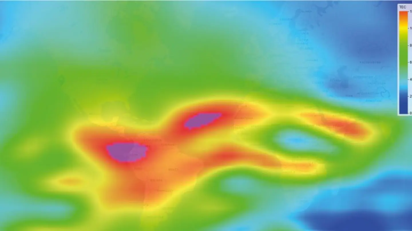
Ionospheric scintillation, caused by irregularities in the Earth’s ionosphere, can rapidly fluctuate the amplitude and phase of GNSS signals, leading to errors in positioning and timing. These effects are particularly problematic for high-precision applications like surveying, autonomous vehicles, and financial transactions. Polarization effects, stemming from the rotation of the signal’s polarization as it passes through the ionosphere, further complicate accurate signal tracking.
Current models often treat these phenomena separately, failing to capture the complex interplay between them. This new framework integrates both scintillation and polarization effects into a single, comprehensive model, offering a more realistic representation of the ionospheric environment. The approach utilizes vector electromagnetic theory, allowing for a more accurate description of the wave-like nature of GNSS signals and their interaction with the ionosphere.
The researchers demonstrated the framework’s capabilities through simulations and analysis of real-world GNSS data. Results indicate that the unified model provides improved accuracy in predicting signal degradation and correcting for positioning errors compared to traditional methods. This is crucial for enhancing the robustness of GNSS-dependent systems against space weather events.
Implications for GNSS Users
The implications of this research are significant for a wide range of GNSS users. For instance, airlines rely on precise positioning data for safe and efficient navigation. Improved scintillation and polarization modeling can lead to more reliable GNSS signals, reducing the risk of disruptions during solar flares or geomagnetic storms. Similarly, the agricultural sector, increasingly adopting precision farming techniques guided by GNSS, could benefit from enhanced accuracy and availability of signals.
Furthermore, the framework has potential applications in space weather forecasting. By providing a more accurate understanding of how the ionosphere affects GNSS signals, it can help predict and mitigate the impact of space weather on critical infrastructure. The research team suggests that incorporating this framework into existing GNSS receivers and processing algorithms could significantly improve the overall performance and reliability of satellite navigation systems.
The study highlights the importance of continued research into the complex interactions between GNSS signals and the ionosphere. As our reliance on satellite navigation grows, so too does the need for robust and accurate models to ensure its dependability. The open-access publication of this research on the ESS Open Archive promotes collaboration and further advancements in the field.
Future work will focus on validating the framework with a larger dataset of GNSS observations and exploring its potential for real-time mitigation of ionospheric effects. The team also plans to investigate the application of this framework to other frequencies and satellite systems.
Image Source: Google | Image Credit: Respective Owner