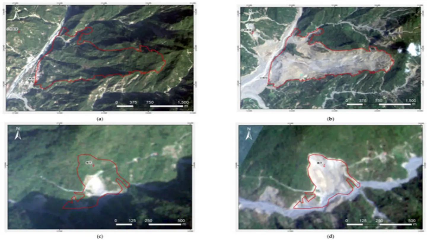
A novel early warning system for debris flows leveraging the Patch Fourier Transformer (PFT) has been developed, promising to enhance the accuracy and timeliness of alerts in vulnerable regions. Debris flows, rapid landslides of mud, rocks, and water, pose a significant threat to communities in mountainous areas, often causing extensive damage and loss of life. Traditional methods for predicting these events rely on rainfall thresholds and geological data, but these can be limited by their accuracy and spatial resolution.
The PFT-based system offers a potential solution by analyzing high-resolution imagery, such as satellite or drone imagery, to detect subtle changes in terrain and vegetation that may indicate an impending debris flow. The Fourier Transform is a mathematical technique that decomposes a signal into its constituent frequencies, allowing for the identification of patterns and anomalies that might not be apparent in the original data. By applying this technique to small patches of imagery, the PFT can capture localized changes in the landscape with greater precision.
How the System Works
The system works by first acquiring a baseline set of imagery of the target area. This baseline data is then processed using the PFT to create a characteristic spectral signature for each patch. As new imagery is acquired, it is compared to the baseline data, and any significant deviations from the expected spectral signature are flagged as potential indicators of instability. These deviations might include changes in vegetation density, surface roughness, or the presence of new cracks or fissures.
Advantages of the PFT Approach
One of the key advantages of the PFT approach is its ability to detect subtle changes that might be missed by traditional methods. It can also be used to monitor large areas more efficiently than ground-based sensors. Furthermore, the system can be integrated with other data sources, such as rainfall data and geological maps, to provide a more comprehensive assessment of risk.
The developers of the system emphasize that it is not intended to replace existing warning systems but rather to complement them and improve their overall effectiveness. By providing earlier and more accurate warnings, the system can help to reduce the impact of debris flows on vulnerable communities, giving them more time to evacuate and protect their property. Further research is underway to refine the system and validate its performance in different environments. The team hopes that this technology can be implemented in areas prone to debris flows globally.
The ongoing research focuses on optimizing the PFT algorithm for different types of terrain and vegetation, as well as developing methods for automatically calibrating the system based on local conditions. The goal is to create a robust and reliable early warning system that can be deployed in a wide range of settings. The success of this project could have a profound impact on disaster preparedness and mitigation in mountainous regions around the world.
Image Source: Google | Image Credit: Respective Owner