A constellation of Chinese FengYun (FY) meteorological satellites is providing unprecedented global monitoring of volcanic sulfur dioxide (SO2) emissions, according to a new study published in ESS Open Archive. The research highlights the capabilities of hyperspectral infrared sounders onboard FY satellites operating in different sun-synchronous orbits – dawn-dusk, mid-morning, and afternoon – to track volcanic plumes and assess their impact on the atmosphere.
Volcanic SO2 is a significant atmospheric pollutant with implications for air quality, climate, and aviation safety. Large eruptions can inject vast amounts of SO2 into the stratosphere, where it can form sulfate aerosols that reflect sunlight and cool the planet. Monitoring these emissions is crucial for understanding volcanic activity and its potential consequences.
The study leverages data from the FY-3D and FY-4A satellites, which carry advanced infrared sounders capable of detecting SO2 in the atmosphere. By combining observations from multiple satellites in different orbits, researchers can obtain more frequent and comprehensive coverage of volcanic plumes around the world. This is particularly important for tracking short-lived or rapidly evolving events.
Satellite Constellation Advantage
The unique advantage of the FengYun constellation lies in its multi-orbital configuration. The dawn-dusk orbit provides measurements at sunrise and sunset, which are optimal for detecting SO2 due to reduced solar interference. The mid-morning and afternoon orbits offer additional observations throughout the day, allowing for a more complete picture of plume dispersion and evolution. The synergistic use of these data streams enhances the accuracy and timeliness of volcanic SO2 monitoring.
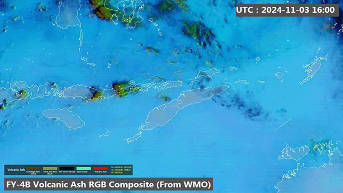
Researchers analyzed data from several recent volcanic eruptions, including those at La Soufrière in St. Vincent, Taal Volcano in the Philippines, and Mount Semeru in Indonesia. The FY satellites successfully detected and tracked SO2 plumes from these eruptions, providing valuable information about their spatial extent, vertical distribution, and temporal evolution. The data also helped to estimate the amount of SO2 released into the atmosphere, which is a key parameter for climate modeling and air quality forecasting.
The study demonstrates the potential of the FengYun satellite constellation to contribute to a global volcanic monitoring system. The data can be used to improve early warning systems for aviation hazards, assess the impact of volcanic eruptions on regional and global climate, and validate atmospheric models. The authors emphasize the importance of continued investment in satellite-based observations for monitoring volcanic activity and other environmental hazards.
Furthermore, the study highlights the growing role of international collaboration in Earth observation. The FengYun satellites are part of a global network of meteorological satellites that provide essential data for weather forecasting, climate monitoring, and disaster management. By sharing data and expertise, scientists around the world can work together to better understand and address the challenges posed by natural hazards and environmental change.
Image Source: Google | Image Credit: Respective Owner